Center for a Sustainable University
Centerfor a Sustainable University
Photo: UHH/Denstorf
22 September 2017, by Tobias Wegener
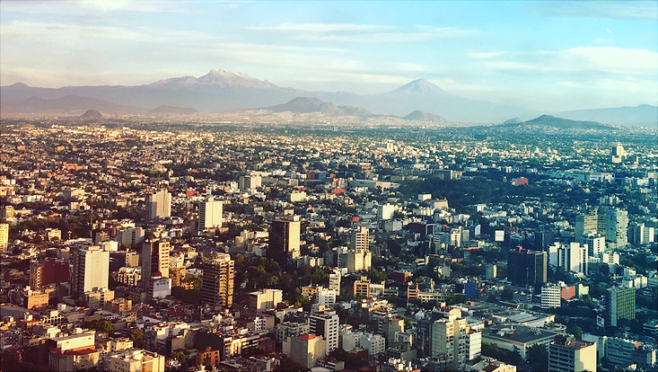
Photo: Unsplah / Alexis Tostado, CC0-Lizenz
The illegal growth of mega cities such as Mexiko City is a big challenge in urban planning. So far it has been quite difficult to evaluate the extent of slum areas as well as other forms of illegal settlements and land uses in a reliable way. However, such data are a prerequisite for social and urban planning measures as well as climate forecasting. In a KNU-funded research project, Dr. Miguel Rodriguez Lopez and Prof. Jürgen Scheffran (Center for Earth System Research and Sustainability) have developed a new method which combines remote sensing satellite data with social data gathered through a so-called human sensing approach. Thereby they were able to map the pattern of illegal city growth in Mexiko City.
Initially satellite data of the southern city boundary from the years 2009 to 2014 were evaluated by means of a geographic information system (GIS). Up to a resolution of five meters, areas were classified either as being natural or settled. Additionally, 18.000 complaints from the civil society regarding illegal settlements in natural reserves were analyzed.
The results suggest that geografic data from remote sensing can be combined with data of human activities from human sensing approaches within a scientific analysis. The provided voluntary geographic information (VGI) turned out to be useful in detecting illegal urban settlements. The existence of a strong association between the expansion of illegal urban settlements and socioeconomic factors open new possibilities of research for a better understanding of urbanization processes.
The new method can be applied to other mega cities and expanded to other human sensing approaches such as VGI data from google or twitter. Especially in Asia and Africa strong urbanization trends are to expect which not only have social and legal implications but also cause climate relevant emissions. Understanding the patterns of urbanization would enable urban planners to develop mitigation and adaptation policies.
Rodriguez Lopez, J. M., Heider, K., & Scheffran, J. (2017). Frontiers of urbanization: Identifying and ex-plaining urbanization hot spots in the south of Mexico City using human and remote sensing. Applied Geog-raphy, 79, 1-10. doi:10.1016/j.apgeog.2016.12.001.
Rodriguez Lopez, J. M., Heider, K., & Scheffran, J. (2017). Human and remote sensing data to investigate the frontiers of urbanization in the south of Mexico City. Data in Brief, 11, 5-11. doi:10.1016/j.dib.2016.12.049.